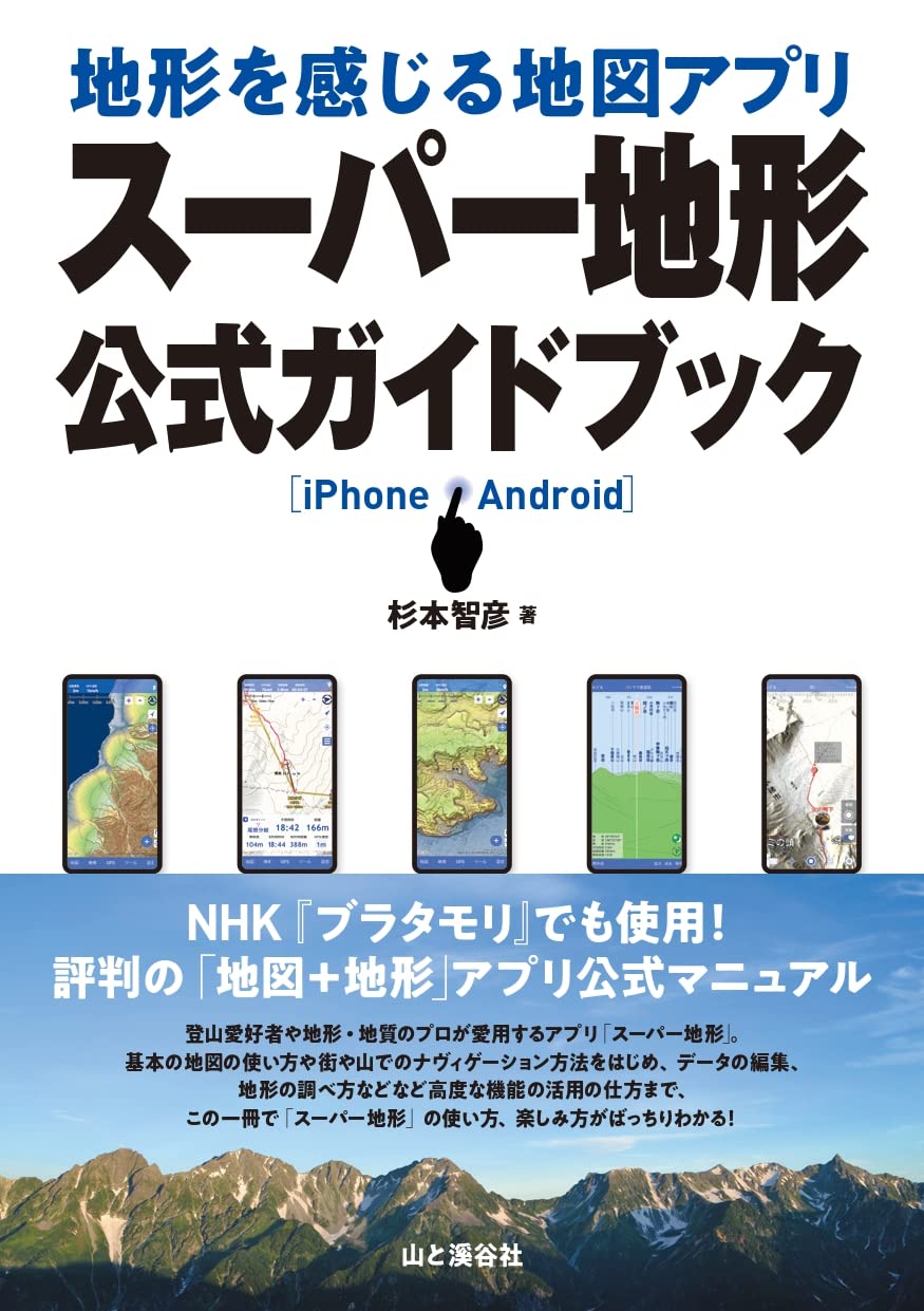
Kashmir 3D "Super Terrain Set" now available as a smartphone app!
GPS, Outdoor, Offline Maps, Old Maps, 3D Compatible
Feel the Terrain with the 3D Map App
"Super Terrain"


Manual book will be released
|
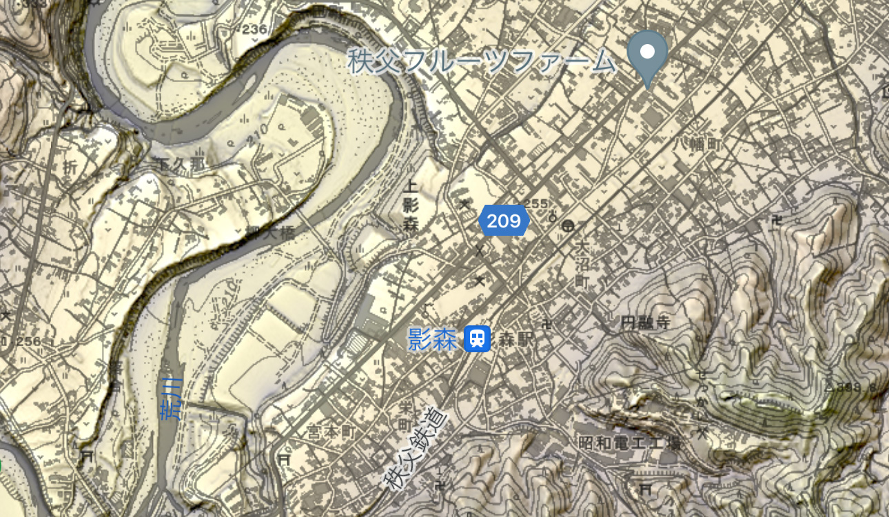
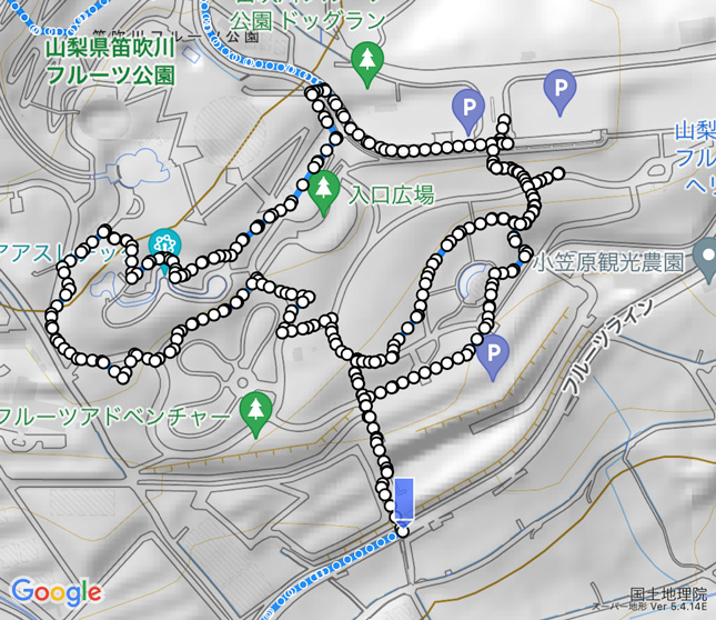
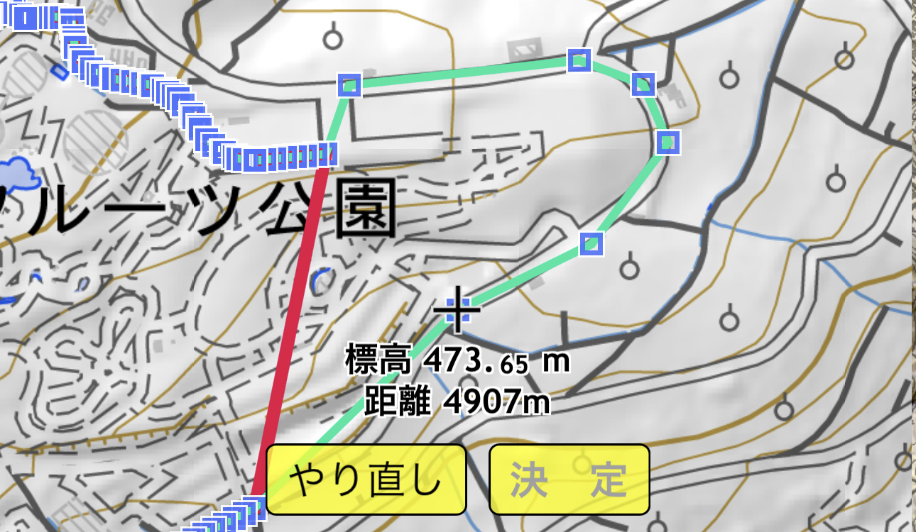
Usage for mountain climbing
|
Update Information (iPhone version) 2023/11/06
Ver 5.7.4
- Support for map printing and PDF output.
- Added the date to the panorama view when the celestial trajectory is long.
- Minor bug fixes.
Update Information (Android version) 2023/11/06
Ver 4.5.28
- Support for map printing and PDF output.
- Added the date to the panorama view when the celestial trajectory is long.
- Minor bug fixes.
See details here
The "Super Terrain Data" used in Kashmir 3D can now be used on your smartphone.
In addition, you can use GSI Maps and Google Maps.
It features full GPS functionality, allowing for GPS data editing and navigation. You can also exchange GPS data with Kashmir 3D.
Supports offline use! You can use the terrain maps for mountain climbing and fieldwork even in areas without signal coverage.
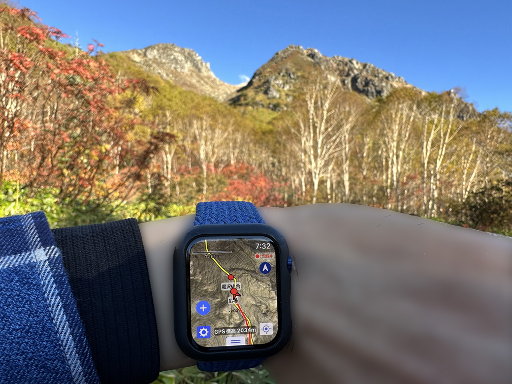
The iPhone version is compatible with Apple Watch.
No need to "read" the terrain from maps anymore. The terrain comes to you.
Feel the Terrain Map
It is a unique map of "Super Terrain". Even complex terrains that are difficult to understand will be emphasized and stand out.
It is also used in the TV program "Bura Tamori".
■ Feel the terrain "Super Terrain Data"
■ Feel the terrain while using the map "Super + Map"
■ Feel the terrain with aerial photos "Super + Photo"
Detailed explanation
Regular Maps
Supports maps published by the Geospatial Information Authority of Japan. They are the same as those used in Kashmir 3D.
■ GSI Map (Planar) Standard map of the Geospatial Information Authority of Japan.
■ GSI Map (3D) Map with relief display added to the standard map.
■ Aerial Photo (Seamless) Aerial photo provided by GSI Map.
■ Aerial Photo (Latest) Aerial photo provided by GSI Map.
■ Aerial Photo (2004) Aerial photo provided by GSI Map.
■ Aerial Photo (1998) Aerial photo provided by GSI Map.
■ Aerial Photo (1984) Aerial photo provided by GSI Map.
■ Aerial Photo (1979) Aerial photo provided by GSI Map.
■ Aerial Photo (1974) Aerial photo provided by GSI Map.
■ Aerial Photo (1961) Aerial photo provided by GSI Map.
■ Aerial Photo (1945) Aerial photo provided by GSI Map.
Detailed explanation
Other Maps
Supports other maps published by the Geospatial Information Authority of Japan.
■ Light-colored Map Map with subdued colors
■ Shaded Map Map representing terrain with shading
■ Slope Map Map representing terrain with slopes
■ Slope Classification Map (Avalanche Related) Map classifying steep slopes prone to avalanches
■ Anaglyph Map for stereoscopic viewing with red-blue glasses
■ Light-colored Map Map with subdued colors
■ Land Condition Map Map of terrain classification
■ Blank Map Map with only administrative boundaries and place names
■ English Version Map with English notation
■ Basic Volcano Map Detailed map of volcanoes
■ Volcano Land Condition Map Map of volcanic terrain classification
■ Lake Map Map of depths usable for fishing
■ Lake Data Map of depths usable for fishing
■ Population Concentration Areas Places where drones can be flown (2010 and 2015)
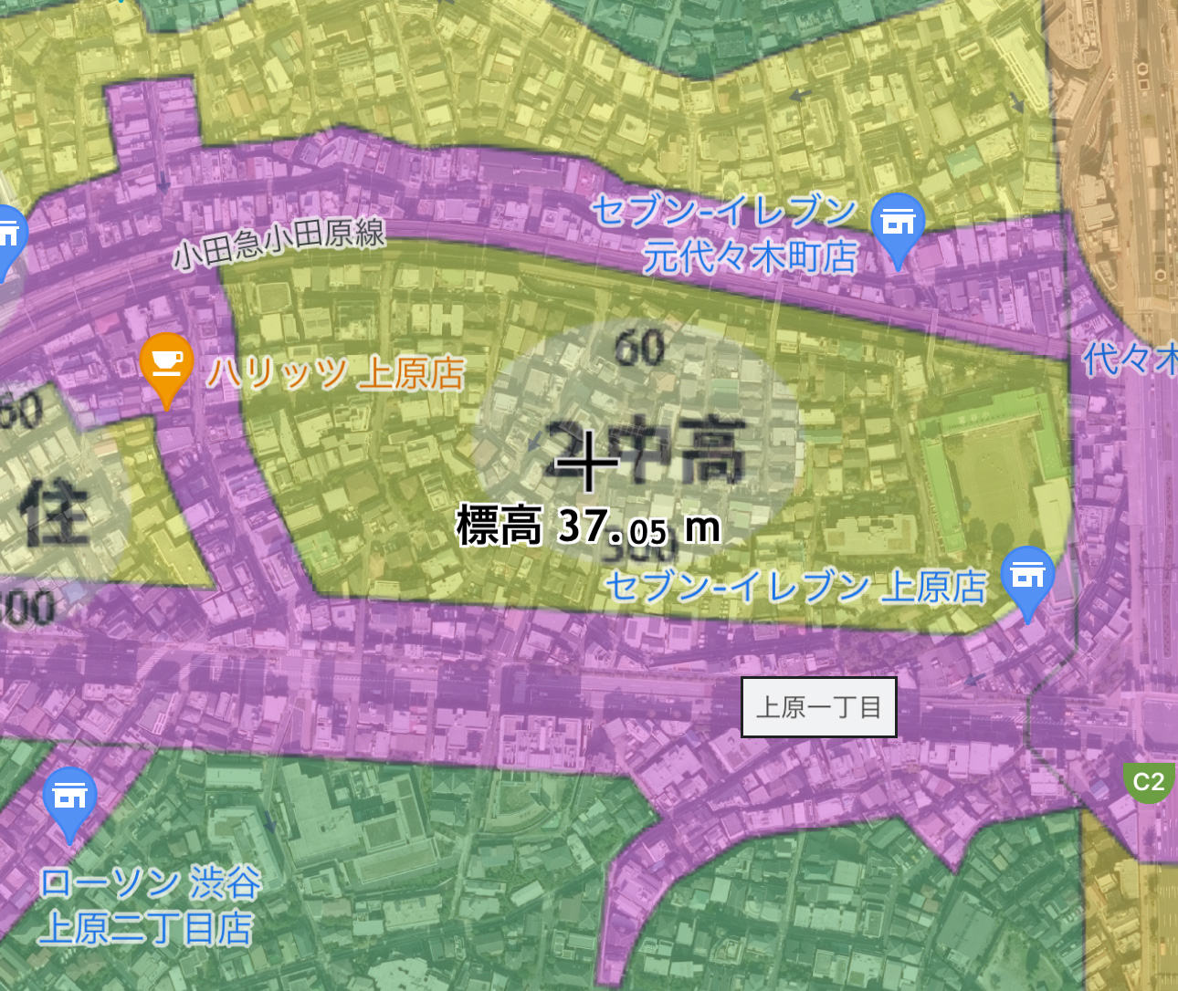
■ Flood Control Terrain Classification Map Detailed terrain classification and river works, etc., included for areas primarily in plains under the jurisdiction of the nation for flood control purposes.
■ Urban Active Fault Map Map showing positions of active faults and terraces
■ Land Use Map Map classifying land use
■ Red Relief Map Map emphasizing terrain as seen on TV programs like "Bura Tamori". Data provided by Asia Air Survey Co., Ltd.
Supports aerial photos quickly taken by the Geospatial Information Authority of Japan during disasters.
They can be combined with GSI Maps, and map colors can be changed.
Here are some examples. When the Geospatial Information Authority of Japan adds new ones, they will be added without an app version upgrade.
■ Kumamoto Earthquake
■ Ontake Eruption
■ Nishinoshima Eruption
■ Hiroshima Heavy Rain
■ Joso City Flood
■ Great East Japan Earthquake
Supports Open Street Map (World Map).
Supports Open Topo Map (Mainly European Terrain Map).
Compatible with historical agricultural environment viewing systems (provided by the National Agriculture and Food Research Organization) showing old maps from the Meiji era (Kanto Rapid Survey and Tokyo Survey Maps).
■ Tokyo Survey Maps
■ Kanto Rapid Survey Maps
Historical Agricultural Environment Viewing System (National Agriculture and Food Research Organization)
Compatible with geological maps provided by the AIST Geological Survey Center.
■ Seamless Geological Map V2
AIST Geological Survey Center
Compatible with vegetation maps provided by Ecolis Co., Ltd.
■ 5th Vegetation Map
Ecolis
Compatible with the Konjyaku Map provided by Mr. Tani.
■ Konjyaku Map
Konjyaku Map on the web
Compatible with pre-war topographic maps (1:50,000 and 1:200,000) using the Japanese Map Warper.
■ Pre-war Topographic Maps (Land Survey Department)
Japanese Map Warper
Detailed explanation
Google Maps
You can also use Google Maps.
■ Google Map (Map) The standard map of Google Map.
■ Google Map (Satellite) The satellite map of Google Map.
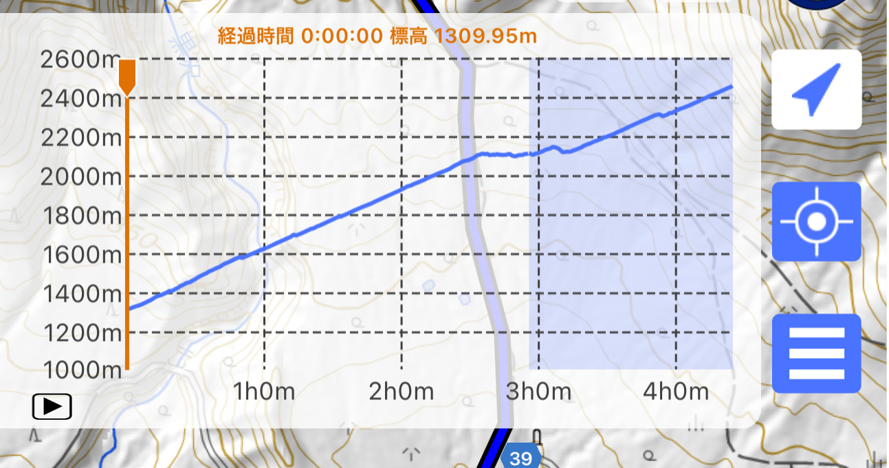
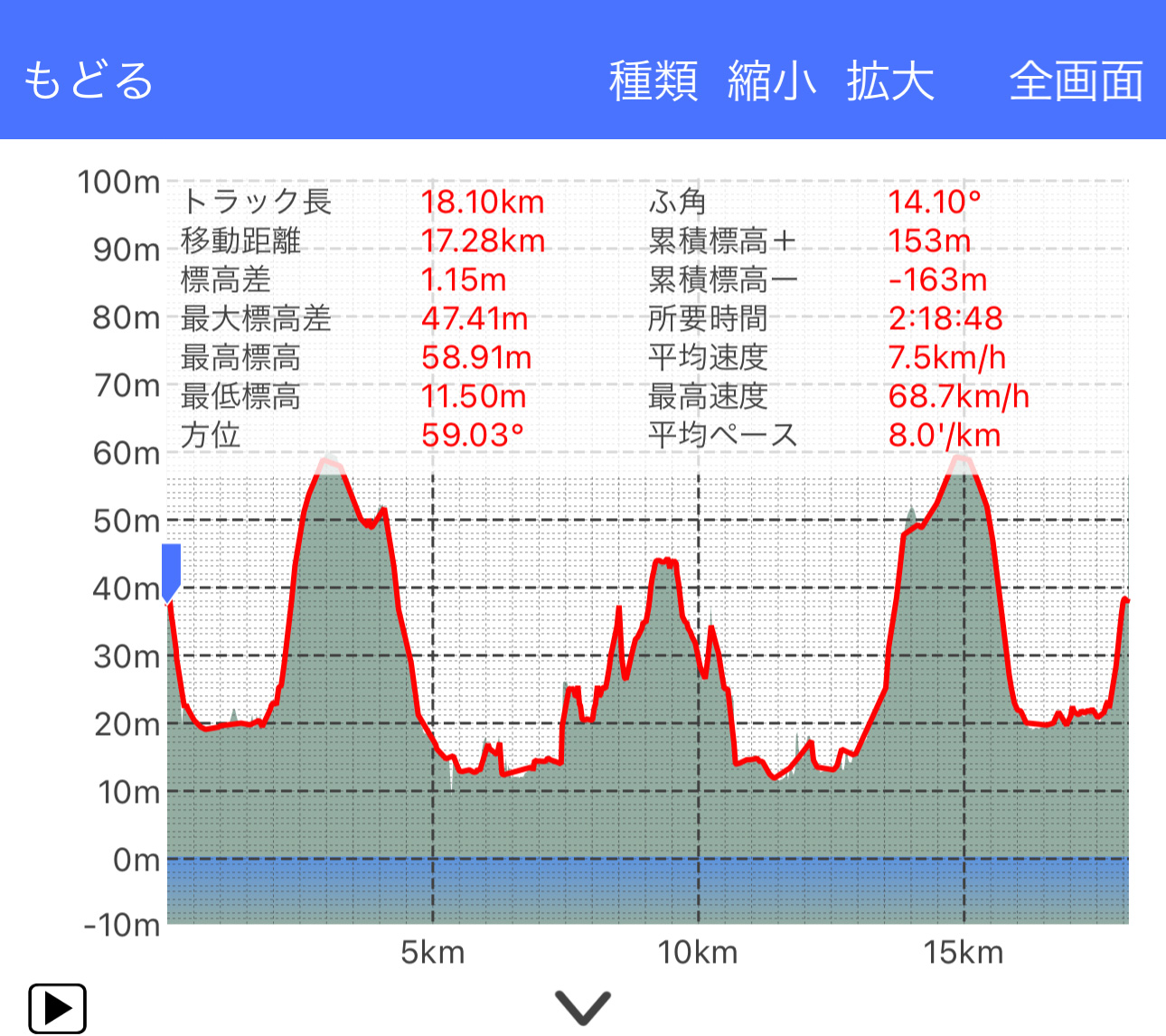
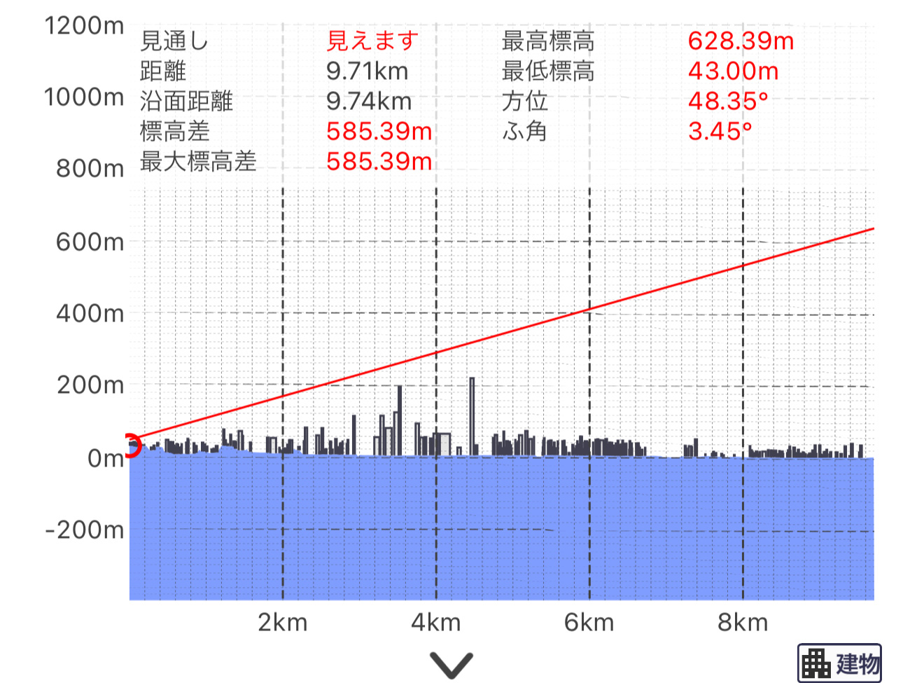
Cross-sectional and Visibility Judgement Features
You can create cross-sectional views at any location between multiple points.
Cross-sectional views can be saved in a list and called up as needed. They can also be converted to GPS track data.
The terrain in the cross-sectional view uses "Super Terrain Data", providing resolution in centimeters where based on 5m mesh. This reproduces significantly more detailed cross-sectional views than commonly used 10m mesh (some areas use 10m mesh).
Also includes visibility judgment features inherited from Kashmir 3D.
You can calculate visibility between two points considering the curvature of the Earth and refraction effects, such as whether Mt. Fuji is visible from a location.
Detailed explanation
Elevation Palette Feature (Gradient Coloring)
You can change the background color of the map.
By changing the elevation palette, you can change the color scheme.
Color schemes can be set in 1cm increments and can be created by yourself.
You can import and export your own color settings using the .PAL file format of Kashmir 3D, so you can share your custom settings with others.
Supported in Android version 2.8.0 and later.
Detailed explanation
360° Panorama View
You can display a 360° panorama view from any location on the map.
The names of visible mountains and place names are displayed, making it ideal for knowing mountain names.
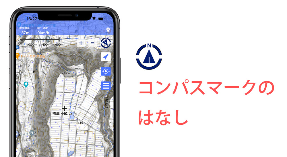
You can also synchronize with the smartphone's compass function to view the panorama in the actual direction.
The positions of the sun and moon, and the lunar phase are displayed with trajectories.
You can use it to find locations like "Diamond Fuji".
You can also display GPS points, so you can check custom points on the map.
Supported in Android version 2.7.0 and later.
Detailed explanation
3D Display
You can display highly detailed terrain using Super Terrain Data in 3D and move it around (using full resolution based on up to 5m mesh).
You can display all available maps (excluding Google Maps) in 3D. You can also view old maps, vegetation maps, urban fault maps, and aerial photos on 3D terrain.
You can display GPS data tracks, routes, points, and current locations, including current recording tracks.
Includes heading-up features.
Currently, you cannot edit GPS data on the 3D display screen.
To use the 3D display feature, you need a device with an A7 chip or later. Devices without this chip cannot use this feature.
Specifically, for the iPhone version, it's available for iPhone 5s and later, iPad mini 2 and later. It may work on iPods with A7 chip and later, but this is not tested.
Currently supported only in the iPhone/iPad version.
AR-capable app also available.
 AR Terrain Model
Detailed explanation
3D Display Demo Video (using Latest Aerial Photos)
3D Display Demo Video (using Latest Aerial Photos)
3D Display Demo Video (using GSI Map)
Offline Bulk Download Feature
To ensure uninterrupted terrain experience, it includes an offline bulk download feature for maps that can be used even when out of signal range (restricted feature).
By selecting and clicking an area, you can download all map data and elevation data of various scales included in that area.
You can securely download and enjoy outdoor activities with a reliable terrain map.
No need for troublesome scrolling.
Note that the bulk download is not intended for downloading all maps nationwide. It is intended for downloading necessary parts.
Also, maps displayed once and cached can be used offline (this feature is free to use).
Detailed explanation
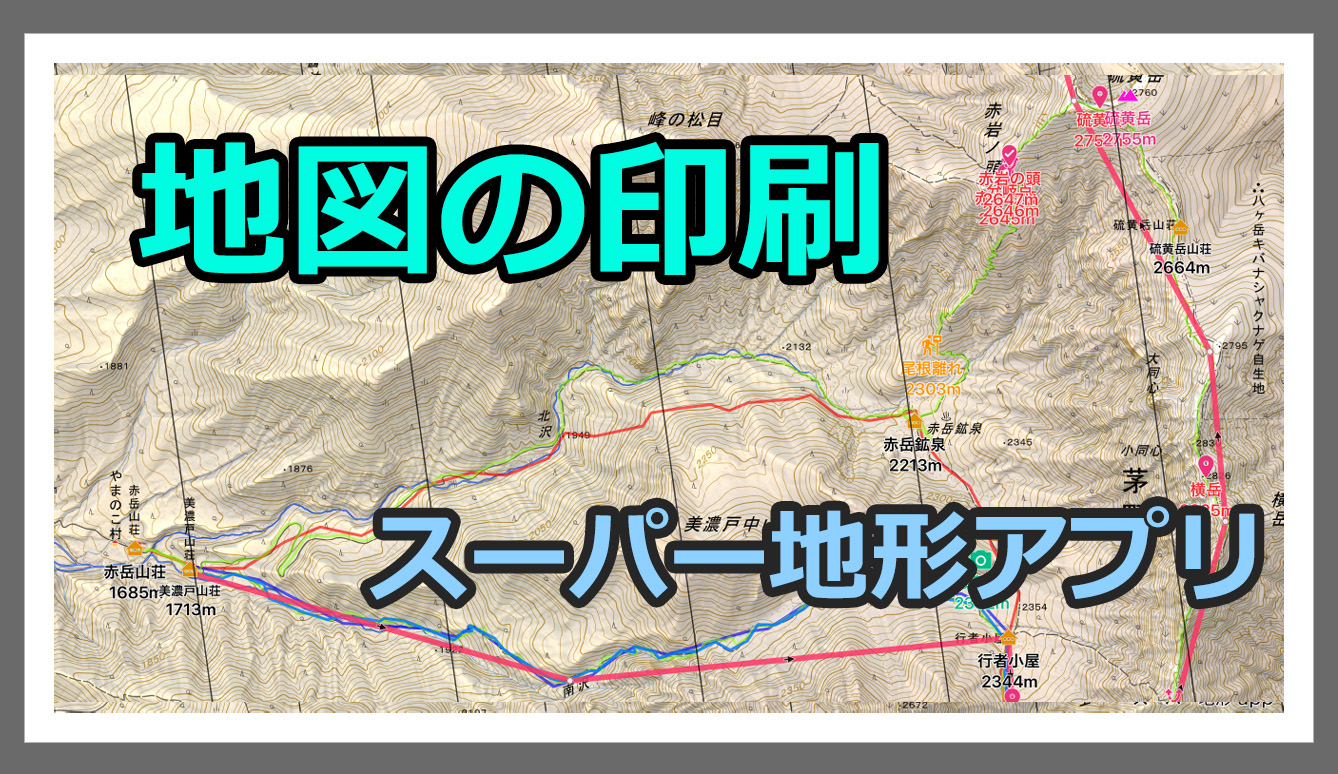
Printing Maps
You can print maps (excluding Google Maps) by specifying paper size and scale.
You can also output to PDF or images.
Even without a printer, you can use convenience store printing services.
Detailed explanation
Contour Overlay Feature
You can overlay highly precise contours calculated from elevation data on all maps.
Small peaks not visible on GSI Map contours become clear.
You can add contours to maps without them, such as Google Maps or OpenStreetMap.
Detailed explanation
Custom Map Feature
You can use custom map format maps cut out from Kashmir 3D.
You can use custom maps composed of multiple sheets, allowing for very large maps.
You can cut out necessary data in Kashmir and use it conveniently on-site.
You can transfer custom maps from Kashmir to the app via email, DropBox, or iTunes shared folders.
Custom maps have no size restrictions.
Even huge maps like those of all Japan are OK.
Detailed explanation
Navigation Feature
Equipped with GPS navigation functions.
You can use Track Navigation, which navigates along the planned track, Route Navigation, which navigates using routes, and Point Navigation, which points to the target point.
In Track Navigation, alarms and voice notifications are given when deviating from the track. In Route Navigation and Point Navigation, alarms and voice notifications are given when approaching waypoints or targets.
You can also set the app to periodically (every 5 or 10 minutes) voice announce the current location, remaining battery, etc.
You can download tracks, routes, and points created by others from websites or create them within the app.
You can also set arrival alarms for points. Independently of navigation, you can be notified of approach to points by voice and alarm.
Here is a brief explanation of the navigation function.
Detailed explanation
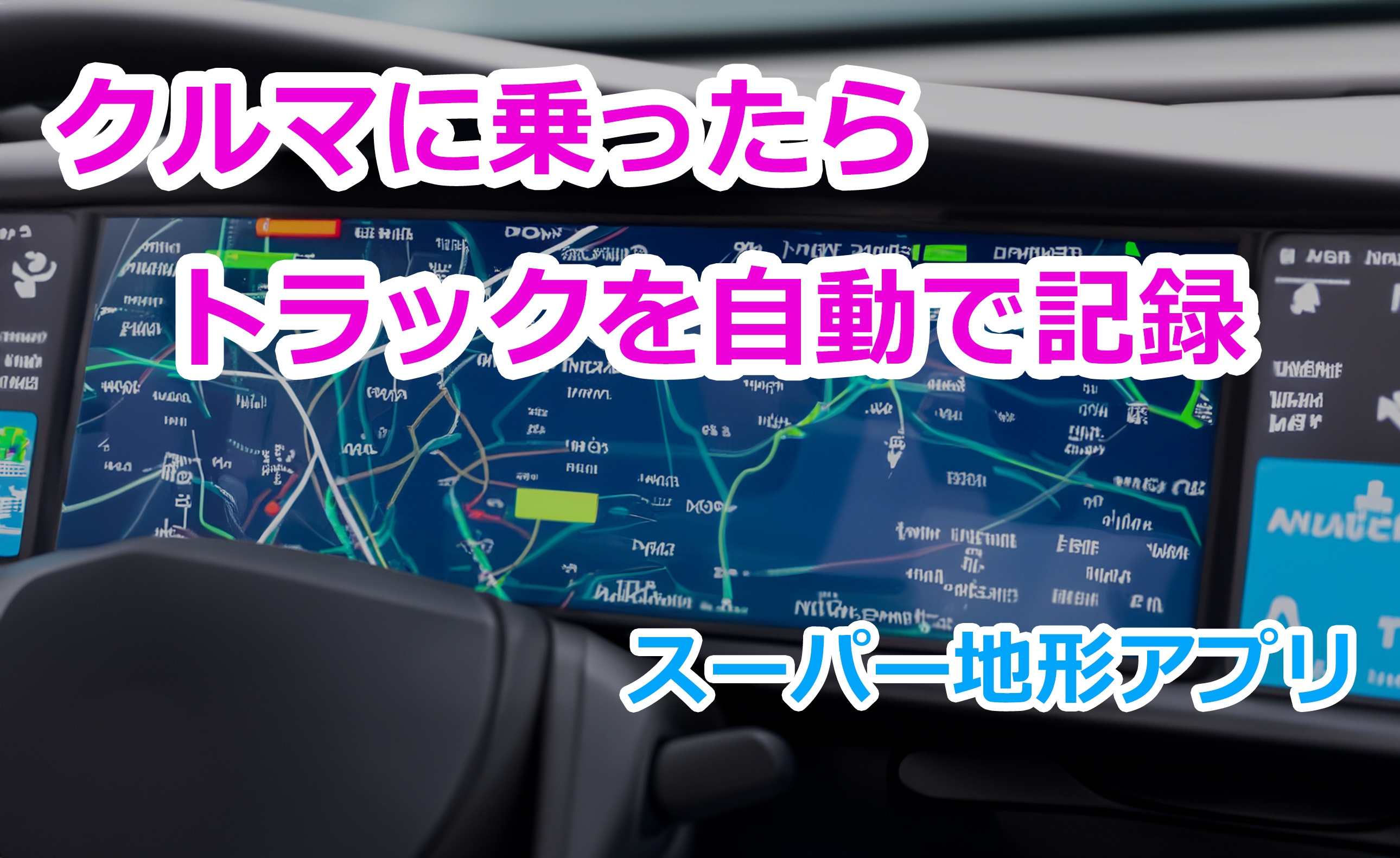
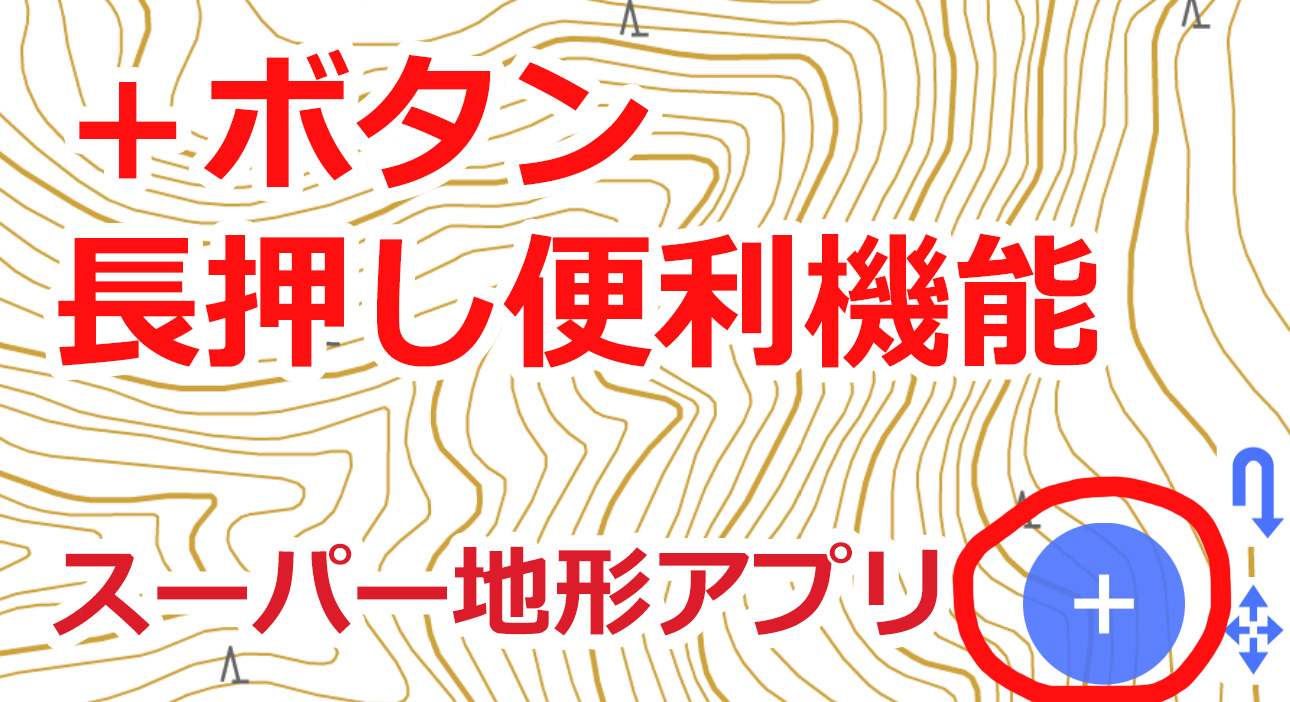
GPS Track (Log), Route Creation, Point Recording
You can record tracks (logs) using the smartphone's GPS function.
You can also create points at any location.
You can create routes from the map.
Detailed explanation
Color-Coding GPS Tracks (Logs)
You can visually distinguish GPS track logs by parameters such as speed, time, gradient, etc.
Currently supported only in the iPhone/iPad version.
Detailed explanation
GPS Track (Log), Route Creation, Point Recording
You can record tracks (logs) using the smartphone's GPS function.
You can also create points at any location.
You can create routes from the map.
Detailed explanation
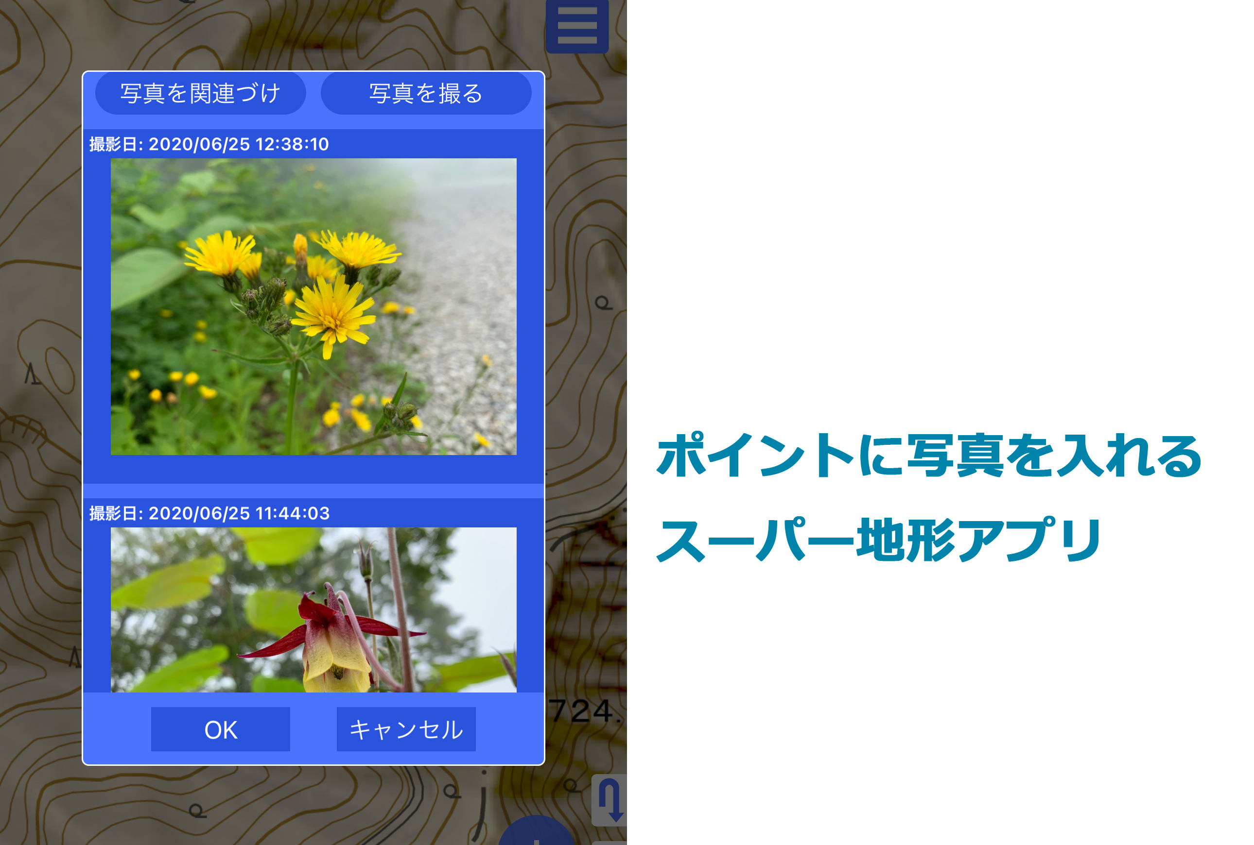
Linking Photos to Points
You can link photos in the smartphone's photo library to points.
Linked photos can be previewed by tapping the point.
Long press the preview to enlarge the display.
Detailed explanation
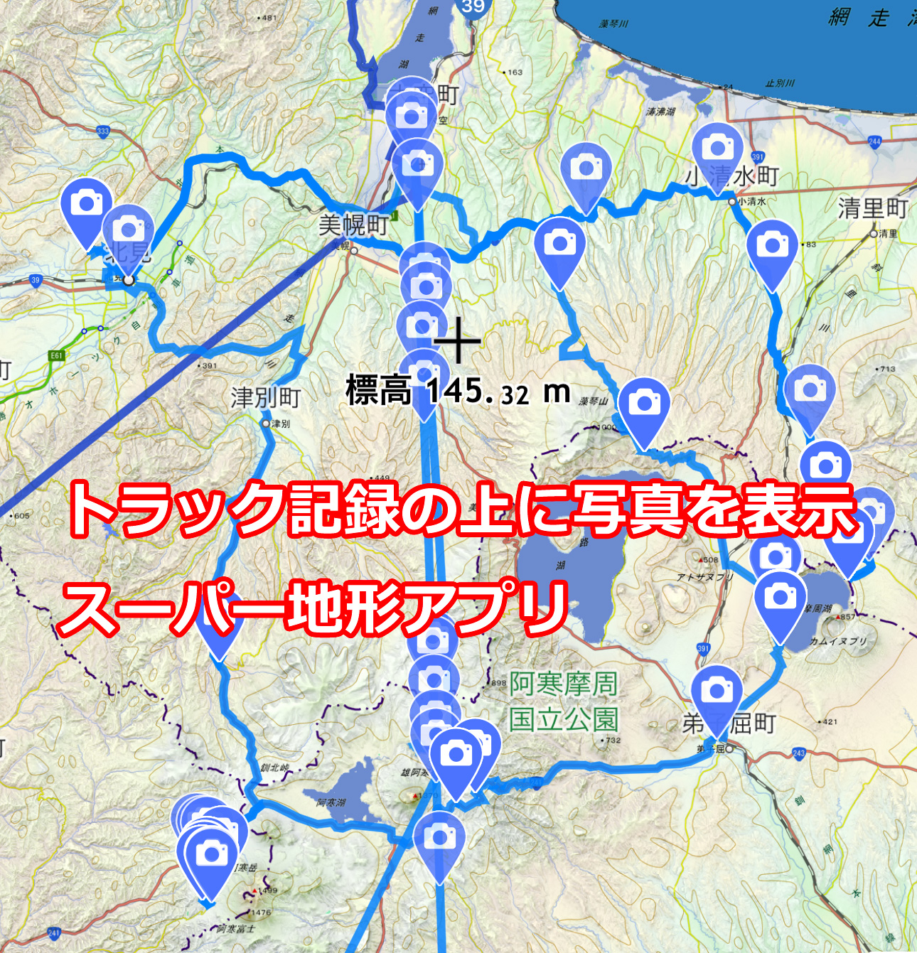
Photo and Track Playback
You can display photos taken when recording the track along with the track playback.
This feature compares the timestamp of photos stored in the smartphone's photo gallery with the track log and automatically displays the photos.
After playback, icons are displayed on the map. Tapping the icons allows manual photo display.
Detailed explanation
3D Track Playback
A feature to playback recorded tracks on a 3D screen.
Photos taken simultaneously are also displayed.
Currently supported only in the iPhone/iPad version.
Detailed explanation
3D Track Playback Demo Video
Apple Watch Support
The iPhone version supports Apple Watch.
You can freely scroll the map on Apple Watch. Explanations can also be displayed for geological maps. Note that Google Maps cannot be displayed, but you can use Open Street Map or Open Topo Map when using overseas.
Navigation information, points, tracks, routes, etc. can also be displayed on the Watch screen.
Warnings for deviation from track navigation can also be issued.
You can operate track acquisition, stop, and navigation pause from the Watch.
Detailed explanation
Editing Tracks and Routes
Equipped with editing functions for connecting multiple tracks and routes, splitting, deleting, moving points, adding new points, etc.
Detailed explanation
Creating Tracks and Routes
You can create tracks and routes directly along the path on the smartphone or create reverse order tracks for descent using ascent tracks and routes.
You can use them for navigation and display estimated walking time based on gradient and distance.
Detailed explanation
Displaying Buildings
You can display approximate building sizes.
In cities where data is available from the Ministry of Land, Infrastructure, Transport and Tourism's PLATEAU project, you can display building sizes in cross-sectional and 3D views.
You can also color-code by height and building area.
Data is limited to certain cities.
Data Exchange with Kashmir 3D
In addition to importing GPS data and custom maps from Kashmir 3D into the "Super Terrain" app, you can also read tracks, routes, and points recorded and created with the "Super Terrain" app in Kashmir 3D.
It supports GDB format, Kashmir's GPS data format, allowing you to use folder structures created in Kashmir.
The reverse is also possible.
Detailed explanation
Search Feature
Equipped with the same place name data as Kashmir 3D. You can search more than 25,000 mountain names by kana or partial names.
You can also search GPS data names, points, tracks, and route notes.
By entering latitude and longitude, UTM coordinates, or MGRS (UTM grid) values, you can display the corresponding positions.
Detailed explanation
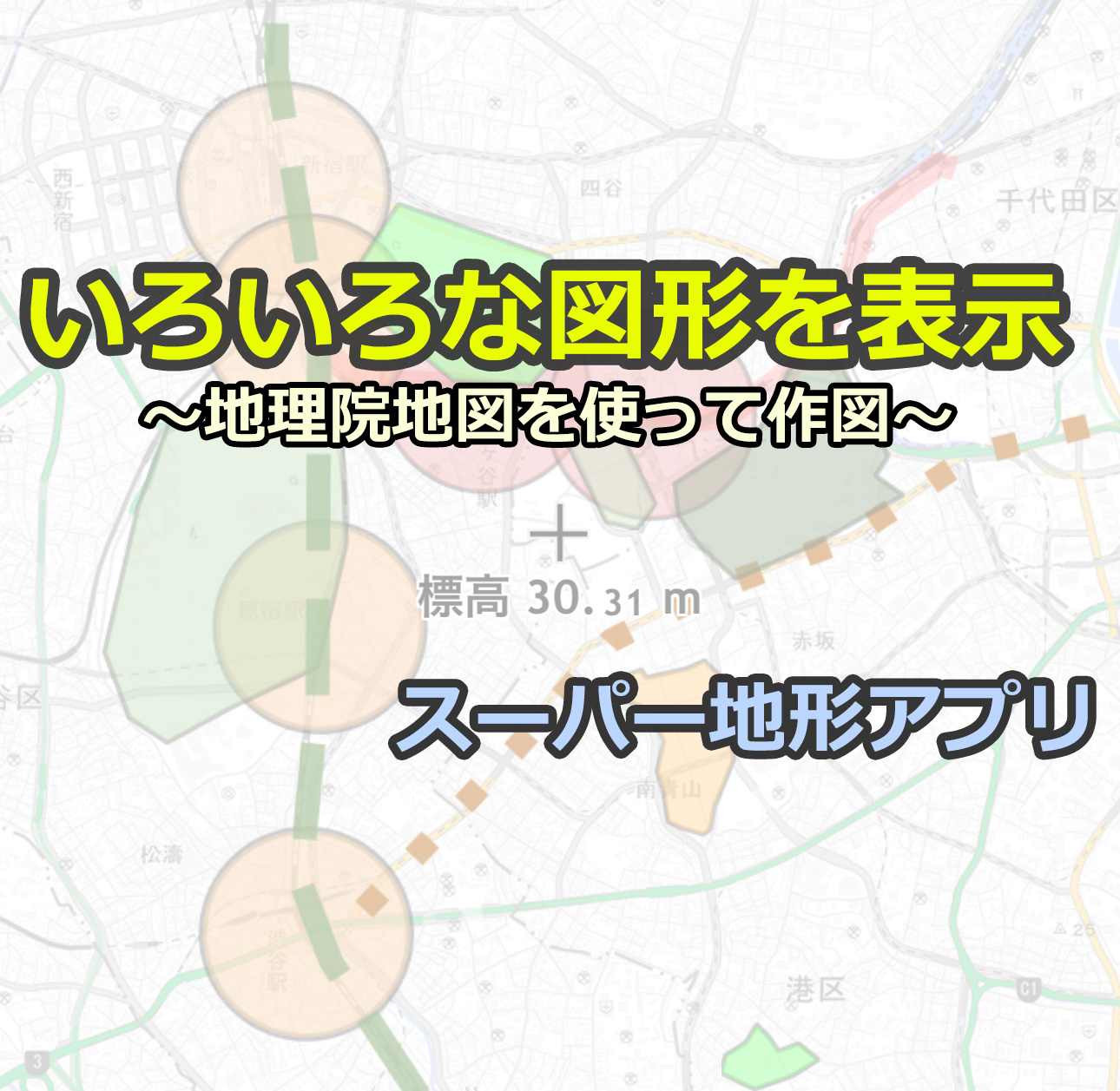
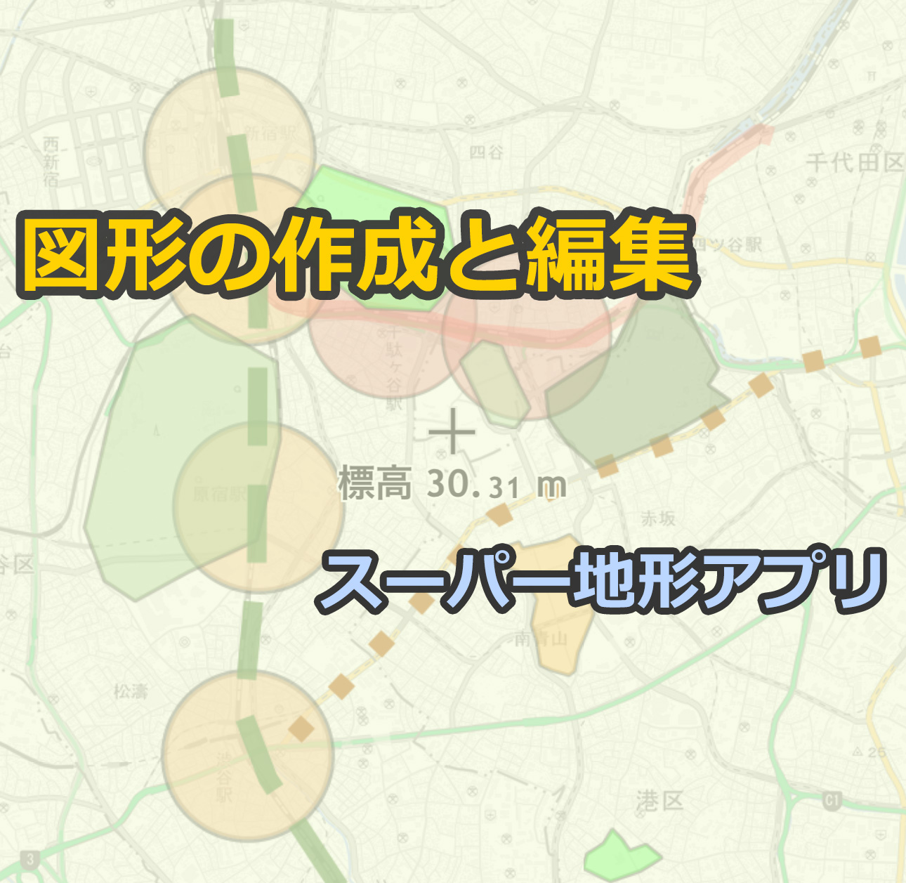
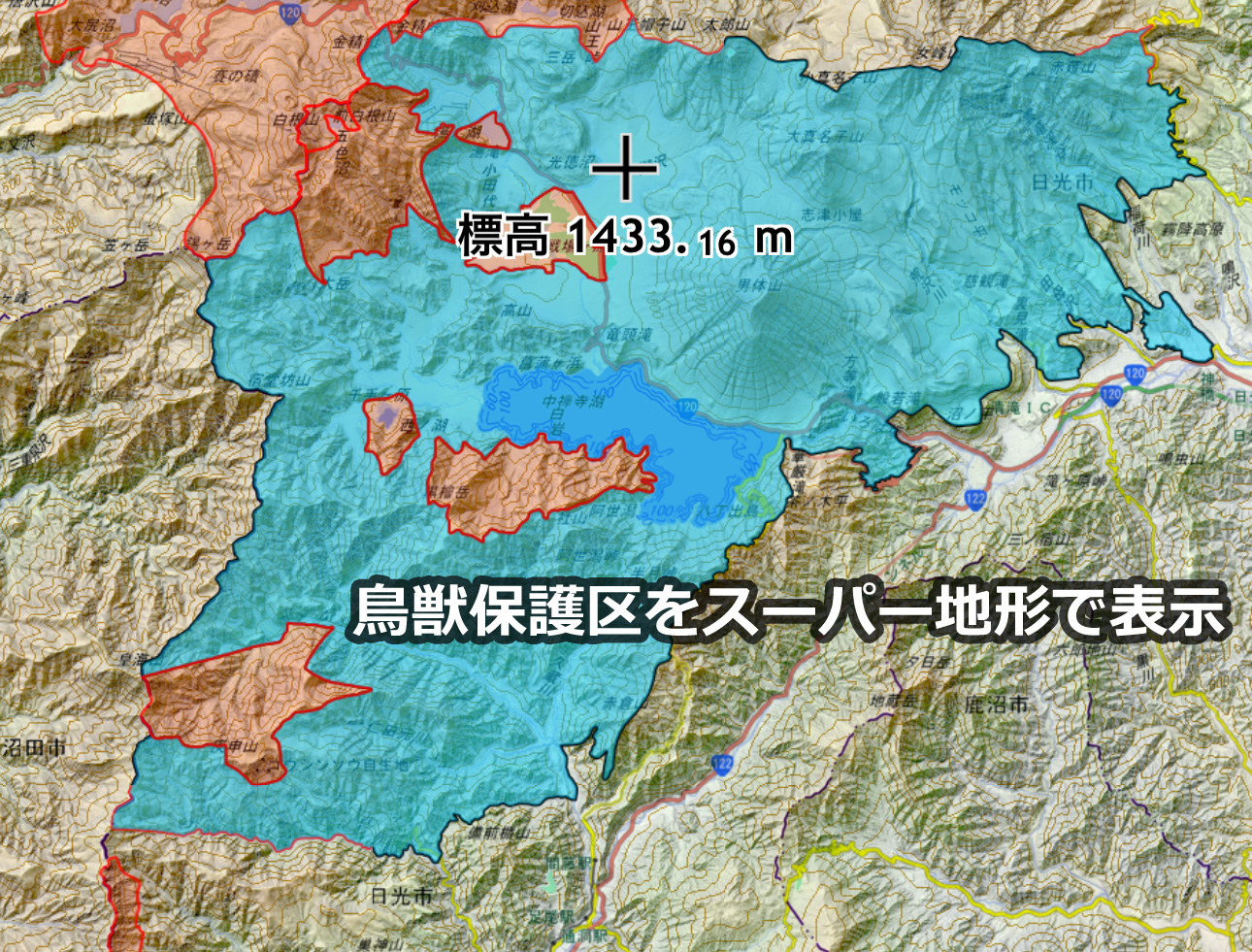
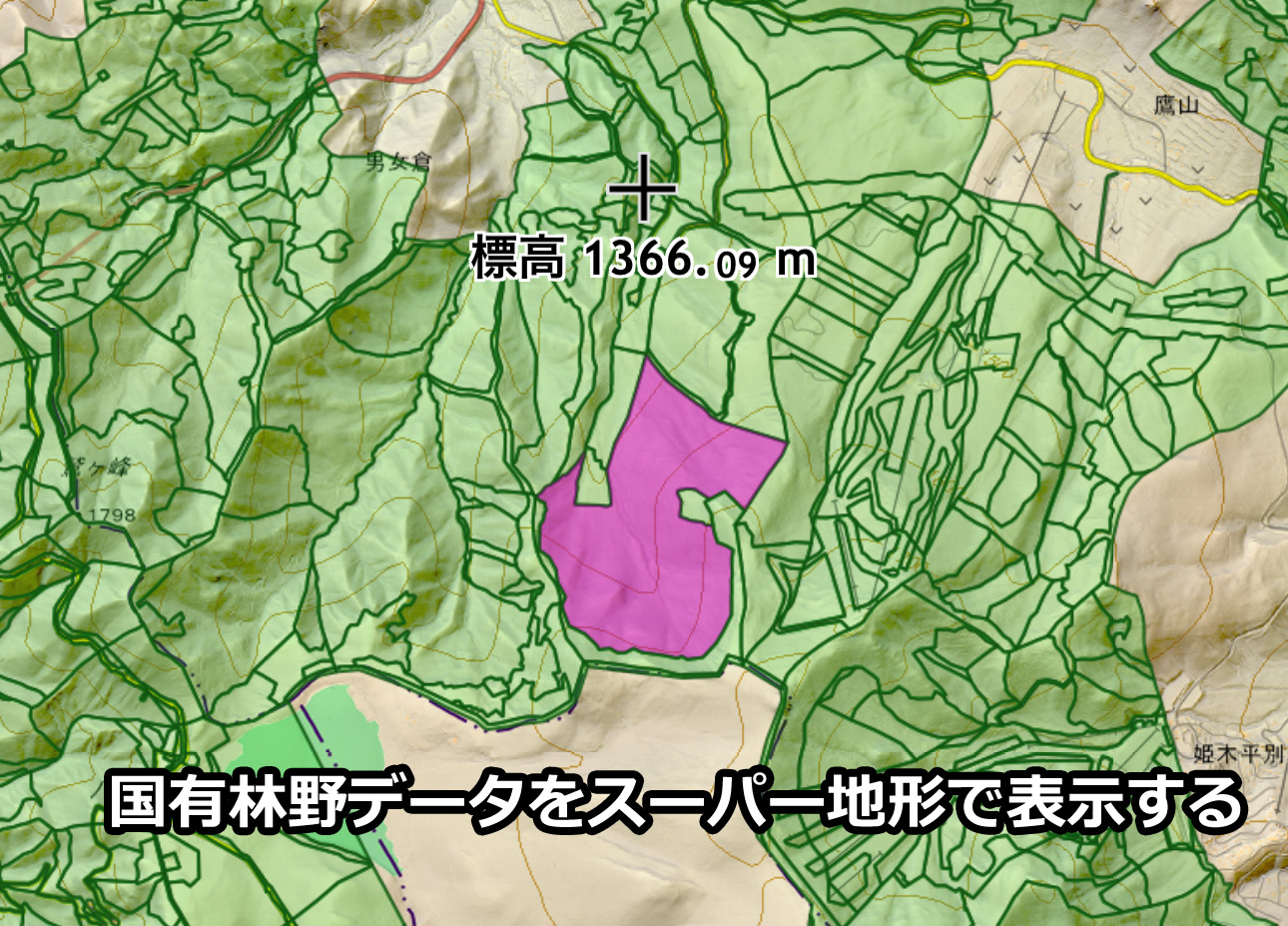
Displaying GeoJSON
You can display GeoJSON files, a format adopted for GIS data.
Wildlife protection areas, agricultural lots, registration office maps, etc., are being freely released one after another.
Some organizations also publish hunter maps in GeoJSON.
Data from the National Land Numerical Information Download Service and the G Spatial Information Center is also distributed in this format. Shape files can be converted to GeoJSON using QGIS.
You can obtain and display these on Super Terrain.
Shapes drawn on GSI Maps can also be saved in GeoJSON and displayed in Super Terrain.
Simulation Feature
Includes a feature to display areas that will be underwater on the map if the sea level rises due to global warming or tsunamis, [Sea Level Rise Simulation].
Detailed explanation
You can also create maps showing how to control altitude to maintain legal heights while flying drones and avoid crashing into the ground.
This is especially useful in complex terrain.
Currently supported only in the iPhone/iPad version.
Detailed explanation
In-App Purchases
All features are available for the first 3 days from installation.
After 3 days, some features will be available with an in-app purchase of "Remove Feature Restrictions".
Please refer to the app page on the App Store or Google Play for prices and details.
Before Using
- For the iPhone version, if you use the same Apple ID, you can use it on subsequent iPhones and iPads without additional charges.
- For the Android version, if you use the same Google ID, you can use it on subsequent devices without additional charges.
- Supports Split View on iPad.
- When first using the app, a message will appear asking if you always want to use location information. Please select "Allow". When recording tracks, it uses location information continuously, even in the background. When not recording tracks, it uses location information only when the app is in use. However, if you do not allow continuous use, you may not be able to use it when needed, so please allow it.
- For the iPhone version, note that some iPod and iPad WiFi models do not have GPS. In such cases, precise location information may not be obtained.
- Continuous use of GPS functionality increases battery consumption. For terminals that also serve as emergency communication devices, consider carrying a mobile battery.
- In areas without signal coverage, putting the device in "Airplane Mode" can help save battery. Additionally, setting the "Super Terrain" app to "Offline Mode" can suppress new map acquisition.
- For the iPhone version, the 3D display uses Apple's Metal technology, so an iPhone/iPad with an A7 chip or later is required.

- The Android version does not support 3D display. All other parts are almost equivalent to the iPhone version.
- Cannot connect to GARMIN GPS.
- Cannot use the PC version Kashmir 3D license. "Remove Feature Restrictions" must be purchased separately.
- Here are some tips for usage, posted from time to time. →

Beginner's Guide (Lectures for Mountain Climbing)
Here is a brief explanation of the navigation function.
About Data Exchange
How to Import GPX Received via Email (From "Super Terrain Official Guidebook")
Privacy Policy
- For inquiries, please contact us here.
AR-capable app also available.
AR Terrain Model
 Map Widget